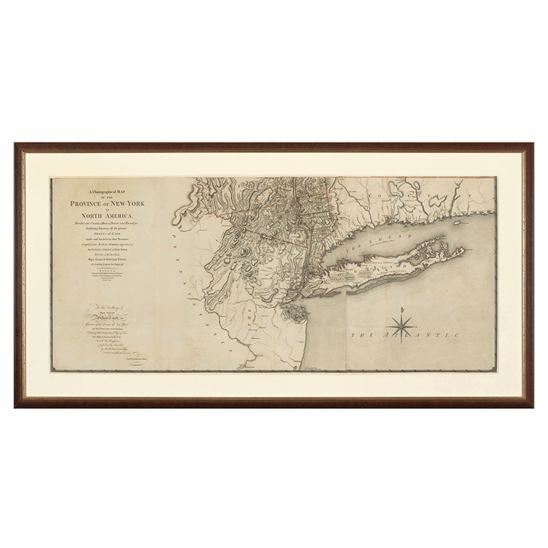


London: William Faden, January 1st, 1779

A Chorographical Map of the Province of New-York in North America, divided into counties, manors, patents and Townships… compiled from Actual Surveys deposited in the Patent Office at New York, by Order of His Excellency Major General William Tryon
The last and best large-scale map of an American colony. drawn on a scale of five miles to the inch, it is the most detailed printed map of any extensive part of North America published during the Revolutionary period.
Claude Joseph Sauthier was one of the most accomplished engineers working in America in the eighteenth century. Alsatian by birth, he accompanied Governor William Tryon to North Carolina in 1769. He surveyed several North Carolina towns and designed the Governor’s Mansion at New Bern before accompanying Tryon to New York in 1771. He subsequently conducted many surveys of New York, and during the Revolution he served as a military engineer producing several fine maps for the British Army. Several Sauthier’s printed and manuscript maps, including an example of the present map, can be found in the collection formed by Sir Henry Clinton, Commander of the British Forces in North America, 1775-1782, now preserved at the William L. Clements Library in Ann Arbor, Michigan. Sauthier’s greatest production was a large manuscript map of the Province of New York which was first published on three sheets in 1776 by William Faden as A Map of the Province of New York. This map included details taken from Bernard Ratzer’s survey of New Jersey. Sauthier continued to improve this great manuscript during the first years of the Revolution, and in 1779 it was published, again by Faden, but greatly enlarged on six sheets, as A Chorographical Map.
This 1779 map contains a vast amount of information lacking from the 1776 map, particularly in upstate New York, the Catskills, and what would become Vermont. A note on the Chorographical Map states that “the Mohawk Valley and County of Tryon are Laid down according to an Actual Survey and other Manuscripts generously communicated by Governor Pownall.” The grand scale, which was almost three times that of the 1776 map, also allowed for the inclusion of many previously omitted details in the more settled areas. The result is an amazing record of New York from the Revolutionary War period.
Measurement: Approximately 75 x 56 inches overall; in three horizontal sections, each consisting of two joined sheets with an approximate size of 25 x 56 inches; good original coloring; each section conservation-mounted under 8-ply museum board mats within walnut frames of 32 x 62 inch exterior dimensions. Frames with UV-Lexan glazing.
Material: Copper-engraving, on six sheets of paper.
Item Condition: Excellent; mending small edge tears and filling missing edge chips using matching period paper, archivally remounting with 8-ply museum board backing and 8-ply window mats under UV-Lexan sheets and replacing missing edge chips and reframing in frames in which they were acquired.
SOLD
SKU 1500-1
For More Information, Please Contact David Hillier at 978-597-8084 or email drh@aaawt.com.
Please click on images to expand.